The West Highland Way
7 Days | 163 km (101 mi) | Intermediate
The West Highland Way, the most famous trail in Scotland, starts in Milngavie (just a few miles north of Glasgow). It will take you all the way to Fort William, ideally located between the fjords and the highest Scottish mountain, the Ben Nevis. The path alternates between hills, mountains, moorland and beautiful local villages.
You will never be too far from civilization but you’ll forget it as you find yourself surrounded by this mystical scenery, inspiration of so many Scottish legends.
Packing List

A detailed and complete list is available below.
Gear
Scottland is famous for its changing weather. The best season to walk the WHW is considered to be May-June. But regardless of the time of the year, prepare for wet and cold weather as well as the infamous midges. The terrain alternates between dry rocky paths and wetter soil, so waterproof shoes are highly recommended. Water won't be a problem but pack at least 2L to be able to last the night. Food
We did the trip in 7 days but it can easily be completed in 6, 5 for the fastest hikers. You can definitely carry all of your food for that period of time, (personal consumption around 500g/day including snacks). But we have met hikers paying 20€/day for bag tranfer service (they transport your heavier gear from one stage to the next, you only have to carry your daypack). You will be crossing quite a number of villages where you will be able to resupply and/or enjoy a nice warm meal. Total Weight
6-7 kg minimum for a daypack, but up to 16-17kg if you decide to carry all of your food and gear. Explore Hiking Gear:
-
Hiking boots
Long sleeves shirt
Merino wool leggings
Hiking pants
Hardshell waterproof jacket
Merino pullover
Underpants | Socks (x3)
Cap | Hat | Gloves
Rain pants | Poncho
-
Water bottle (2-3L)
Tent (waterproof)
Sleeping bag (0°C)
Sleeping mat
Backpack (70L)
Walking sticks
Cooking pot | Gas
Fork | Spoon | Knife
Sunglasses
Headlamp
Microfiber towel
Pillow | Eye mask | Earplugs
Toiletries
Pharmacy | Vaseline
Mosquito Spray + Face net
Trash bag
Toilet paper
Candles | Lighters
Blister tape
Tick remover
Wistle
-
Smartphone | Watch
Powerbank | Charging cords
Explore Food List:
-
Oat: 50g/day
Trail Mix: 20g/day
Instant coffee: 2/day
-
Sandwiches (resupply every 2 days)
Hard cheese
Dried meat
Bread
-
Lyophilised meals (1/ day)
Chocolate tab
-
Energy bars (2/day minimum)
Dried fruits
Commuting
From Glasgow Queen Street, a local train takes you to Milngavie (see schedule) for £3.90 in 2023. They run pretty often but I recommend to get one of the early ones, so you avoid a potential stream of hikers at the start. Milngavie is a small town where you will be able to find a coffee place and purchase the last missing items.
From Fort William, we took the train back to Glasgow for £26.40. There are quite a few a day but I recommend you book tickets in advance. The train crosses the Highlands, giving you both a last glance at its beautiful landscapes, as well as a reminder of what you just accomplished.
Report
163.26 km | 3,381 m+ | 35h
(moving times do not include breaks)
-
Once you have reached Milngavie, the signs are easy to follow to the official starts of the WHW. The first miles will most likely be packed with fellow hikers, hence the recommendation to start rather early. It will take roughly an hour for you to leave civilization behind and eventually reach the first fields. It will be a rather easy day, comparably flat, taking you through tiny little villages until you reach Drymen.
If you arrive early enough, you can treat yourself by going to a local pub. The town also has a small shop. Don’t hesitate to ask the locals for recommendations as per where to pitch the tent. For ourselves, we found the perfect site under the pine while carrying on a couple miles after leaving Drymen behind. They provide a relative shelter from the rain as well as a comfortable cushion for sore backs.
-
Wake up with the sun, enjoy your first breakfast in nature and after packing up, keep crossing the forest. If you are lcuky as we were, you might spot deers and their likes.
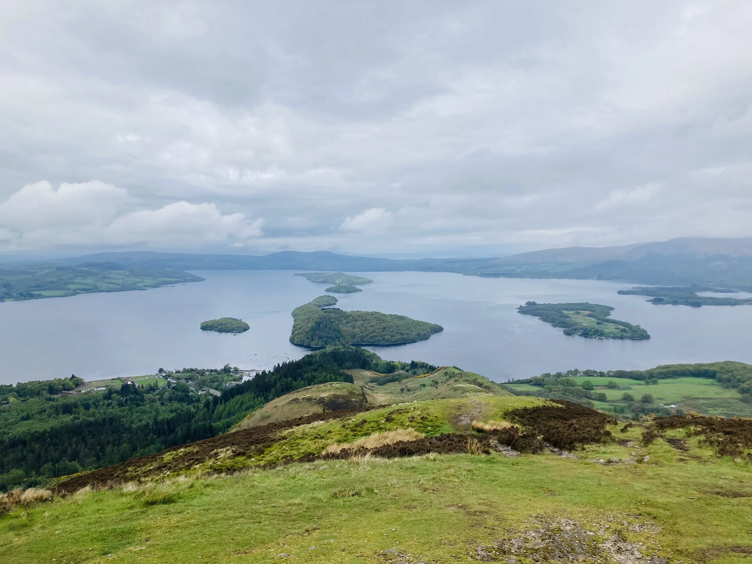
You will then reach moor land, populated with lots of sheeps. A short climb will get you to the top of Conic Hill, where sits the best panorama over Loch Lomond. From there, it will take you about 30 minutes to reach the port, where you will find a café offering breakfast options. From there on, you will stay on the lake most of the next 2 days. 5km later, a small beach can present a nice sitting for lunch, a nap and a short bath should the weather allow.
About another 5km later you will see a pub on your left hand side. It was so sunny that day, and their garden so welcoming that we paused there for a while. But you can decide to directly push to the youth hostel 15 minutes further, and set camp on the lake. For a small fee you will be allowed to pitch the tent in the forest, enjoy a shower, amenities, and eat breakfast the next morning!
-
The day will start with a walk in the forest after a short climb in the trees. I believe there is a path by the lake but we hoped for a better view uphill. Not to worry, you will reach the shores soon enough and follow them for a while. We met quite a number of peaceful local goats (?) on the path. When you will have walked a total of 11km, and right after crossing a bridge over an imposing waterfall, you will reach a lodge. The amenities comprise a room for hikers to charge their phone and shelter for an unforgiving weather.
But as famously known, said weather is unforeseeable and constantly changing. Therefore, you might be able to set temporary camp at a beach 4-5km further down the road, where we stayed about an hour for lunch, “laundry”, and a nap in the sun.
A camping site will present itself once you have completed the remaining 7km, in a very highland-like landscape. The site offers a small shop for hikers groceries too. We found a spot about 5 minutes out from the camping site, by the river. It was obviously rather humid and can be the “perfect” midges nest, so be prepared.
-
You will very soon reach beautiful landscapes, possibly still covered with a mystical morning fog… but neighbouring a highway. Luckily, you will eventually leave it behind as you climb uphill to probably the best 2 hours of walking we had so far. At the end of this small valley, you will have the opportunity to take a right and divert from the path, to reach a small village. There is indeed a grocery shop but do not count too much on the pub or café, opening hours were not reliable.
After reaching the official path again, you might feel you actually are in Switzerland, as you wander amongst pine trees, green fields and cosy cottages. The end of the stage is a strange little town, apparently famous for bikers. A bigger shop and a couple of diners and guesthouses will provide you with the opportunity for warm food.
You also won’t have to walk too long to find a nice camping site - with a view!
-
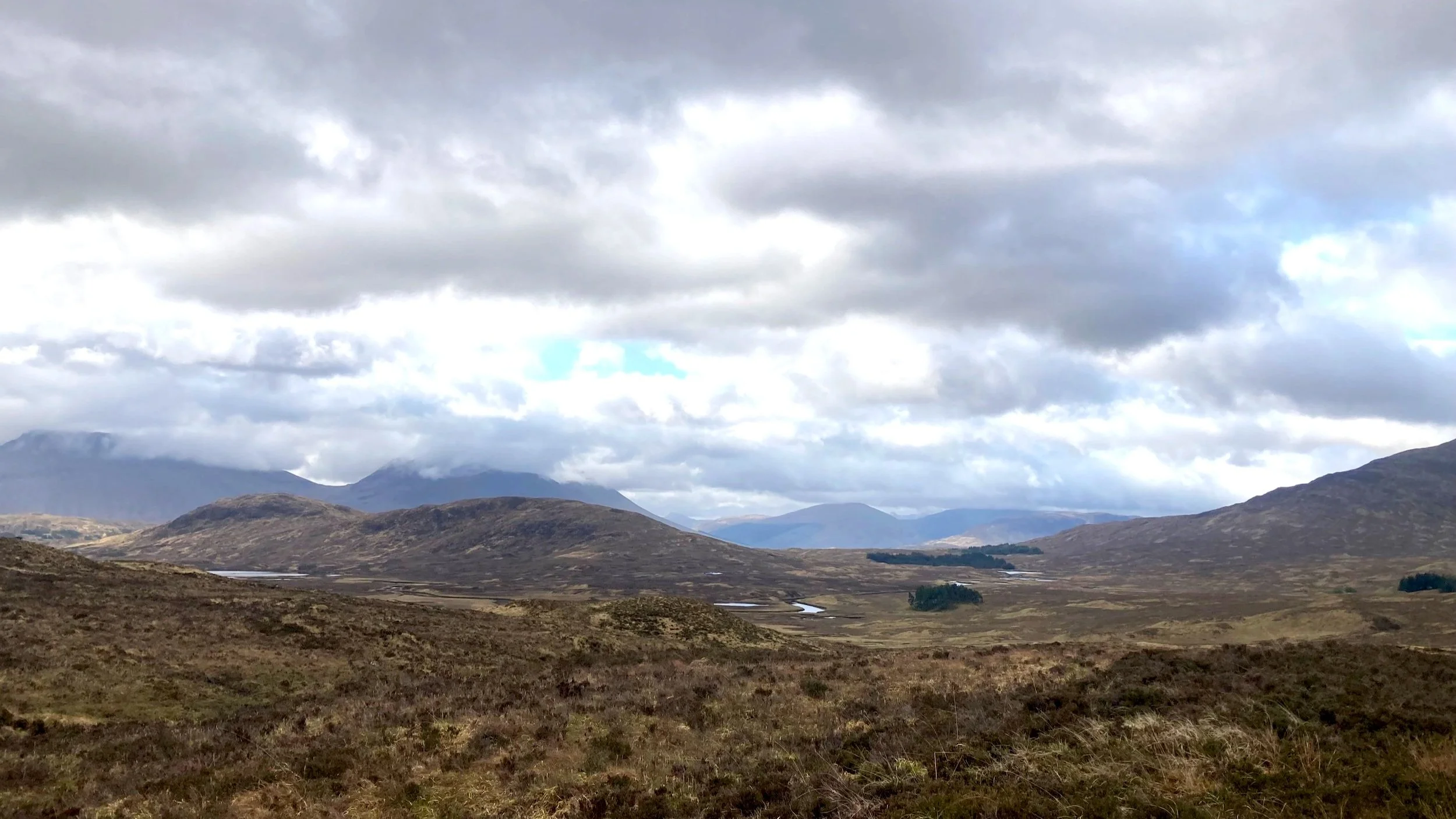
We woke up under a light rain and walked for about 10 km amongst the peaks, crossing farms and peat fields. The beginning is comparaby flat and easy to walk. You will have to climb a peak before going down to Inveroran where you will find a small shop and a nice little pub for a well deserved break.
Once back on the tracks, a gentle climb will bring you to amazing moorland, far from eveything. There are plenty of spots where to pitch your tent but we settled for one amongst the trees in the forest and just by a small river (perfect for a bit of laundry and get fresh water), a few kilometers before Kinghouse. The night was cold, even in May, so again a warning to carry appropriate gear.
-
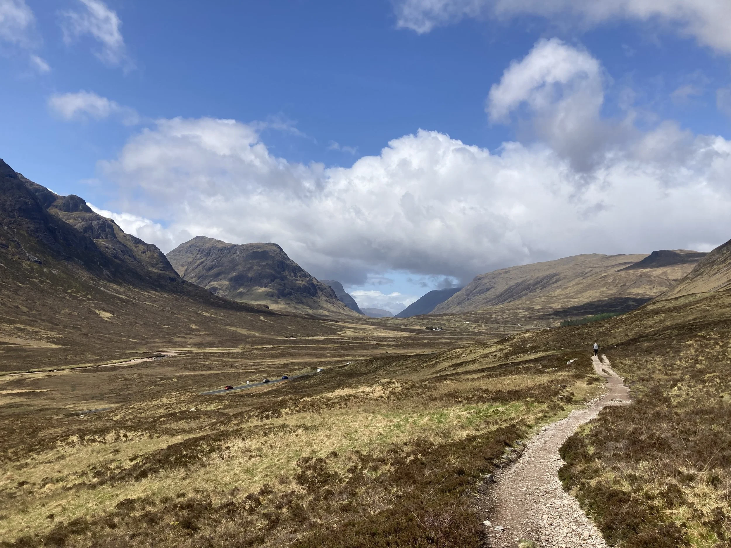
In the morning, we got confirmation it could snow at higher altitudes even in May, as we noticed the surrounding peaks had turned white during the night! Not to worry, a one-hour walk will take you to Kinghouse where a lodge will permit to warm-up and get a nice breakfast should you feel like it. It’s location also makes it the perfect opportunity to meet locals or fellow hikers!
Soon after we left, the strongest storm so far allowed us to confirm our ger was waterproof. But the next 4-5 km allowed us to dry a bit, before tackling the big daily climb. Its top will present you with a 360° panoramic view as well as a nice lunch spot, should the weather be kind.
Then will begin a long walk down to Kinglochleven. We did not meet too many pitch-worthy spots and therefore settled for the local camping site. A hot shower, meal and drinks in the pub are also factors that played in the decision process.
-
The camping sites are usually well populated with hikers, and we can only recommend to start early if you want to avoid te crowd. You won’t have much time to stretch your legs as the stage starts with a steep and lengthy climb to the plateau.
From there, it is a nice stroll between two mountain chains, far from civilization (probably 15km), before you will go down and up one last time, crossing forests and cattle. The last part takes you down to Fort William, with the possibility to divert last minute and reach the official camping site at the foot of the Ben Nevis (highest mountain in Scotland). Arriving early will allow you to pick a spot in the shade of the trees, keep this in mind ;-) !
-
The weather did not allow us to, but you can stay one more day a the camping site (or start very early) and climb the local pride as a nice way to end your trip !
Good To Know
Neither coverage nor water will present a problem. You will get plenty of it along the way.
Maps can curely be purchased but the trail is well marked. We personally bought a small guide, easy to carry. You can also download a couple Apps, just like maps.me (offline maps).
Toilets are available public houses, restaurants, camping sites, and you will cross plenty of them, not to worry!
Nothing to worry about wildlife and therefore nor cattle dogs.
Midges are know to be a pain come the hotter months and a face net is highly recommended!
Budget
| Expense Items | Increment | Costs |
|---|---|---|
| Flights To and From Scotland | 200£ | |
| Train Glasgow - WHW | 30£ | |
| 2 Nights in Glasgow | 80£ | |
| Pre-bought Food | 80£ | |
| Resupply + Restaurants | 70£ | |
| Camping | 40£ | |
| Extras | 50£ | |
| Total | 550£ |
Year 2022, only indicative and can vary based on price changes, the equipment you need to purchase, the extras you allow yourslef.
Resources

Official website with latest updates, maps, stage reports and other pieces of information!

Purchase tickets in advance for a better price and more seat/bed options.
A very complete app for offline maps.